
Welcome to Yarmouth Then and Now: A Pictorial History, where the past and present of our charming town come to life through captivating images. Explore a visual journey that showcases Yarmouth’s rich heritage and remarkable transformation over the years. Our collection features side-by-side photographs, offering a unique glimpse into how historic landmarks, streetscapes, and community spaces have evolved. From vintage snapshots to modern-day captures, witness the growth and changes that have shaped Yarmouth into the vibrant community it is today. Dive into our pictorial history and discover the fascinating story of Yarmouth, one image at a time.
South Yarmouth
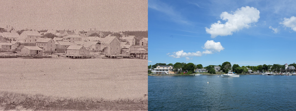
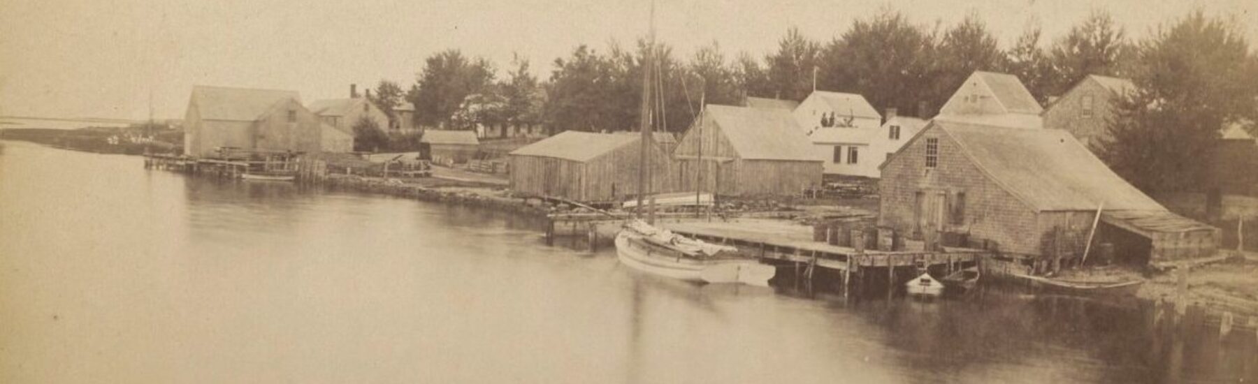
At one time, this area acted as the northeast corner of the former Indian reservation (1713 – 1799). Seen from the eastern shore of Bass River in West Dennis near Ferry Street, this 1885 photograph shows how vibrant the current day Packet Landing was during this period. Buildings of note: tall building on right adjacent to bridge was Loring Fuller’s Coal & Grain Store; low sloping building to the left of the store was the Akin’s forge; the three-story building behind the forge was the Cellar House; the tall building behind the Cellar House was the Wing Brothers Store with the second floor acting as the second South Yarmouth Library. All these buildings are gone or have been removed.
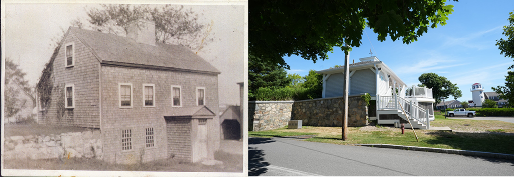
This picture of the Cellar House circa 1900, at Packet Landing (now 6 Pleasant Street), was named for being able to walk into the house on the first floor and being able to walk out by the cellar. It was built circa 1794 when Abiel Akin married Catherine Killey on land Akin bought of his father-in-law David Killey. All there children were born here. In 1795 the basement was employed by a Potter named Purrington, and upstairs was a sail cloth manufacturer. This house was raised in the 1990s and the town erected Packet Landing Pavilion on this site.
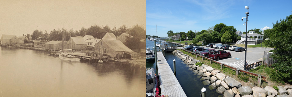
This picture of the Packet Landing area was taken from the Bass River Bridge circa 1880. On the right, the long-sloped roof building was the forge of Abiel and Timothy Akin. On the left the large building was the Cooper Shop of Frederick P. Baker built when the Bass River bridge was erected. It is the site of the former Ferry landing and adjoins Union Street. None of the buildings pictured here are still standing. Packet Landing Pavilion now occupies this site.
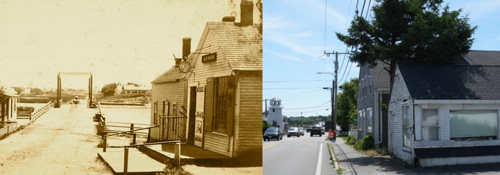
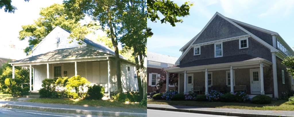
This picture circa 1900, shows Bridge Street (now Route 28) on the South Yarmouth side. The low cape style house on the left was built in 1810 by Abiel Akin. It was then sold to Capt. Amos Kelley who ran a lumber coaster from Maine to Cape Cod. Today the building is the art studio of Ann Sullivan.
The building on the right originally acted as the jewelry store and clock shop of David K. Akin and sat on the other side of the street towards the river. It was moved in the 1850s to this location. It acted as the first South Yarmouth Post office.
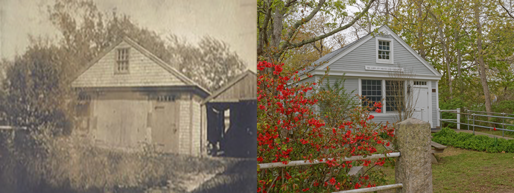
This building built about 1815 was the one room District 7 Schoolhouse. It originally was located near Mill Lane set back from Old Main Street. It has been moved many times and had many uses. In the early 20th century, Manton Crowell had it moved behind his mortuary, facing Bellevue Avenue and acted as his paint store.
About 1960 Aaron Davis, who with Ralph D. Kelley, revived the Yarmouth Friends Meeting, brought the old schoolhouse to the grounds of the Yarmouth Friends where it acts as a place of hospitality for the Yarmouth Friends. 58 North Main Street, South Yarmouth.
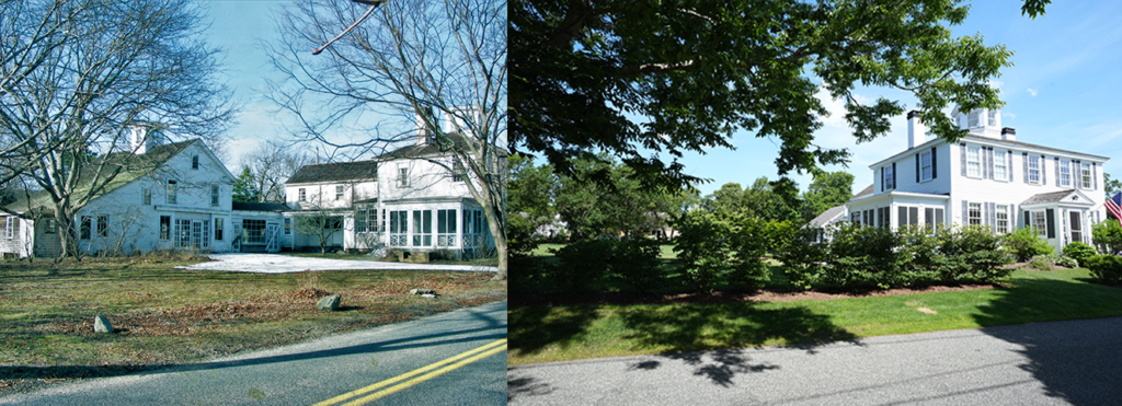
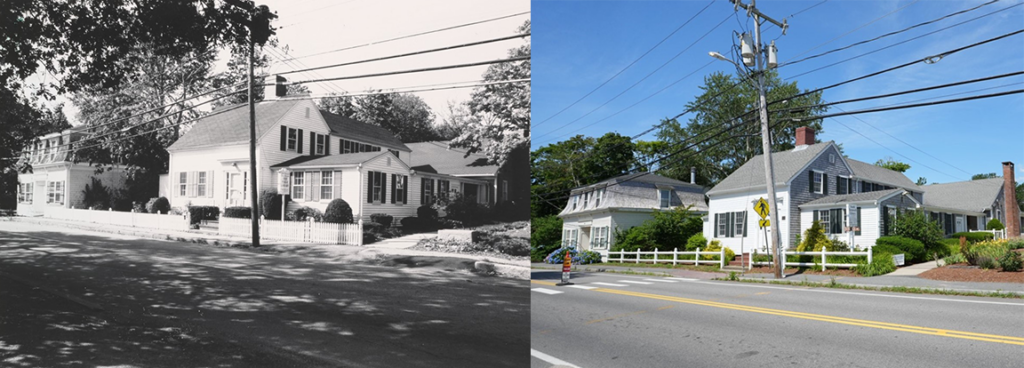
This picture circa 1980 was originally the residence of David K. Akin. Even though the deed dates to 1836, Akin was a part owner of the land it sits on and built the house about 1830. Akin was a member of the Yarmouth Society of Friends. In 2011 this house was renovated and sold. The barn and connecting building were removed. 34 Pleasant Street, South Yarmouth.
This picture circa 1910. The building in the back picture on the left of the three buildings was known as the Wing Brother’s store. This store was built in 1856 in North Dennis for Prince Howes, Merchant. The store was sold to David K. Akin & Stephen Wing in May 1866, who moved the building to Pleasant and Bridge Streets. The Wing brothers sold this building in 1926 to Uriah Sears who moved it to 31 Pond Street where it sits today.
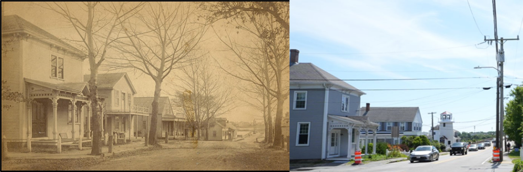
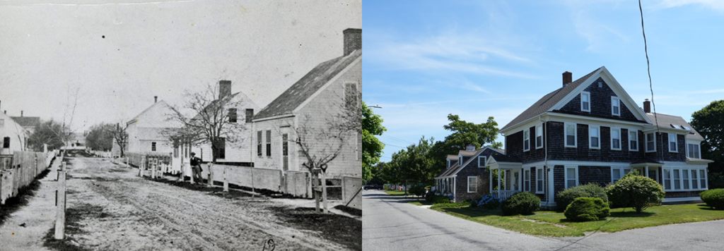
Taken from the corner of Bridge Street (now Route 28) and Bellevue Avenue, this picture shows buildings on the north sie of Bellevue Avenue. Building on the left was the first Bass River Savings Bank. The second building was the store of Manton Crowell, who was also the undertaker in town. Third building unknown. Fourth building, set back was the blacksmith’s shop. Fifth building was the Toll House.
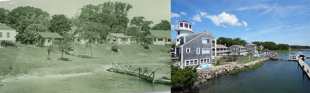
This 1930s picture of Riverview Cottages was located just northerly of the Bass River Bridge on Route 28. They were owned by David Kelley 2nd (1870 – 1937).
This picture taken circa 1960 was the Owl Club. Originally the barn attached to the house at 6 Akin Avenue, belonging to Daniel Wing, moved to Old Main Street in 1945. 307 Old Main Street, South Yarmouth,
Located at 312 Old Main Street, this picture taken circa 1940, best known as the Zenas Wood house, became the fourth South Yarmouth Library. In 1820 Zeno Killey sells land with dwelling house to Ebenezer Hallet Ju., who in 1831 sells a quarter-acre of this land to Moses Burgess. Burgess builds a dwelling-house and in 1846 sells the property to Elizabeth Hawes, wife of John Hawes, deceased, and Lydia Wood, wife of Zenas Wood Ju., containing a dwelling house.
Article written by: Bob Kelley
Photography credit: Dan Gorham