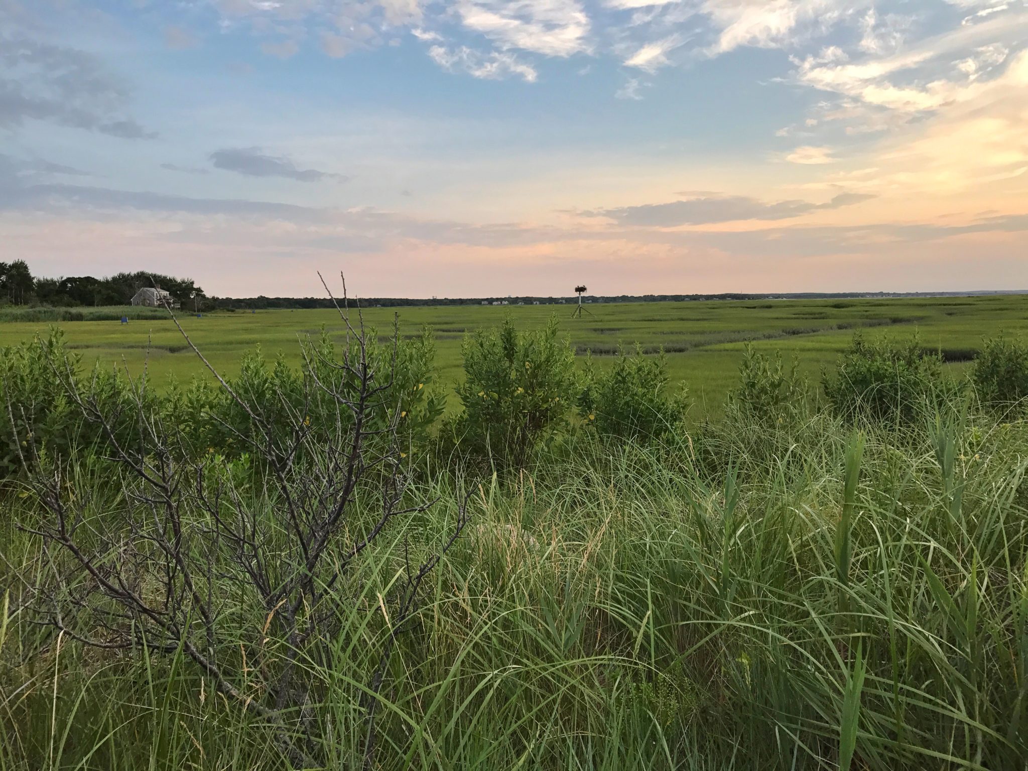
Gray’s Beach
One of the best ways to appreciate the nature and history of Yarmouth is enjoying a walk down one of our historical lanes or hiking on one of our nature trails. On foot, you have the time to enjoy the natural beauty of the seashore, marshes, botanical trails, or the 18th and 19th century architecture of the sea captain’s homes and the churches that are linked to the founding of the town.
No matter the time of year, we all want to get outside and enjoy Cape Cod’s salty air with a nice walk. Lucky for us, Yarmouth has many beautiful hiking paths on Conservation Land, sidewalks for strolling, and a great stretch of shoreline for those seaside walks. Here are our favorites!
By Cindi Griffin, Cape Interactive Media

Botanical Trails
#1 The Botanical Trails at the Historical Society of Yarmouth
A favorite walk among residents of Yarmouth is hidden just behind the Yarmouth Port Post Office off of Route 6A. The Botanical Trails, or Nature Trails, of the Historical Society of Yarmouth, boast a nature lovers dream of plants and tree specimens that add a bit of variety to a traditional walk through the woods. If you’re a first timer, this is one walk worth taking with the Trail Map and Nature Trail Guide so you can see where you are, and know when to stop and look for notable flora, fauna and geological points of interest. You can pick up the guide at the gatehouse at the beginning of the trail and, no matter the time of year, it’s a good idea to apply your bug repellent. The trail winds around Miller Pond, one of Cape Cod’s many kettle ponds formed by glacial ice deposits, and has some variety of terrain that is great for sure-footed adults and older children.
At the end of the trail you’ll see the lovely little Kelley Chapel, a non-denominational chapel built in 1873 and donated to the Historical Society in 1960 when it was moved from the Georgetown area along Bass River in South Yarmouth. Kelley Chapel is available mid-spring through December for special events and weddings.
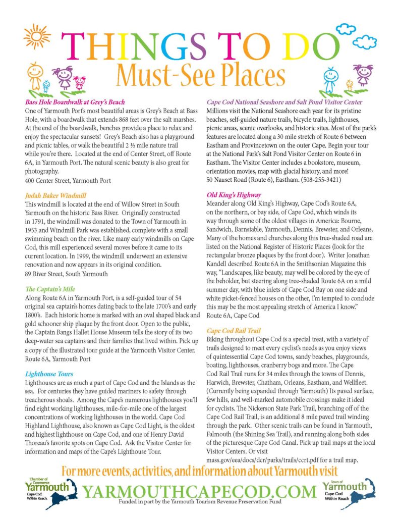
Gray’s Beach
#2 The Callery-Darling Conservation Trails at Gray’s Beach
The Callery-Darling trails that wind through the marshes of Yarmouth Port, have some of the best payoffs of any hike in the Mid-Cape area. Follow the trail that takes you through the Center Street Marshes (entrance located on west side of the road), and you’ll find a whimsical old fashioned swing, and a spectacular view of Barnstable’s Sandy Neck. On the east side, the trails wind through the Chase Garden Creek Marsh, with views overlooking the Grey’s Beach and Chapin Memorial Beach in Dennis. MAP/GUIDE.

Captains’ Mile
#3 The Captains’ Mile
Getting to know the historical significance of the Old King’s Highway and it’s early residents, with a nice stroll along the “Captains’ Mile” on Route 6A in Yarmouth Port. MAP/GUIDE. The black and gold relief carved plaques featuring a schooner ship signify each captain’s home on the Captains’ Mile, which are now mainly private residents. To see inside, visit the Captain Bangs Hallet House at 11 Strawberry Lane on the north side of the village green. If you’re into supernatural history, you can also download the Ghosts, Myths and Legends guide to accompany you on your tour. GUIDE.
#4 Old South Yarmouth and Bass River Village Walking Tour
On the south side of Yarmouth is another historical walking tour through Bass River Village. On top of the Greek Revival architecture we see so prominently on the north side, there are homes with charming Victorian and Italianate flourishes and a history in keeping with Yarmouth’s seafaring founders. MAP/GUIDE.

Crab Creek

Bass River Beach
#5 South Shore Drive
One of the longest stretches of shoreline (about 1.3 miles) in Yarmouth runs from Bass River Beach (aka “Smuggler’s Beach”) along South Shore Drive to Thacher Park Beach. Lined with oceanfront hotels, beach cottages, private residences, public and resident-only beaches, South Shore Drive also has a sidewalk that’s perfect for walkers and joggers who want to take in the fresh ocean breeze. Those interested in a longer walk, can park at the Bass River Beach lot (see in season fees) and walk the beach, with several options to double-back and return up to the paved sidewalk via South Middle Beach, Parker’s River Beach, Seaview Beach or Thacher Park Beach, which is quite convenient since the beautiful soft sand of the Nantucket Sound beaches are a little more difficult for running and walking than you might expect. If you want an even longer walk, keep following the sidewalk past Bass River Beach down South Street, which also connects to Old Main Street. Along the way, you’ll enjoy seeing many beautiful homes, gardens and points of interest. If you work up an appetite, there’s a new gelateria, Caffe Gelato Bertini, next to the Great Island Bakery on South Street, and the Skipper Restaurant and Chowder House, which also serves ice cream, on South Shore Drive.